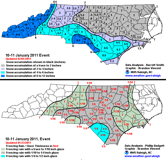
Winter Storm Event
|
Snow, Freezing Rain
Started: January 10, 2011 at 12 am EST Ended: January 11, 2011 at 1 pm EST |
|||
| A slow moving storm system tracking from the Gulf of Mexico northeast along the Carolina coast interacted with cold air in pace across the state resulting in a prolonged period of snow which changed over to freezing rain as the storm approached. The heaviest snowfall occurred across the Sandhills to the South Carolina border and in the west across the foothills and mountains. A mix of snow and freezing rain fell across the Triangle and Triad making travel hazardous and resulted in a number of vehicle accidents. | |||
| Injuries | not available | Deaths | not available |
| Property Damage | not available | Crop Damage | not available |
| Atmospheric Maps | Large-scale maps of 500 mb Heights, Jet Stream Winds, and Sea Level Pressure from this event | ||
| Event Analysis from the National Weather Service in Raleigh | |||
 |
|||
| Weather Station Data
Snow Sleet Freezing Rain Rain Mix |
|||
|
|
|||
Back to the Winter Storm Database main page