Chill Models for North Carolina
Many fruit crops must experience enough cool weather before they come out of winter dormancy. This internal “clock” ensures that they don’t begin to bud out and flower too early in the year when they run the risk of experiencing a cold snap that could damage tender leaves and new growth. This tool enables users to explore accumulated chill hours for the current season using several common fruit models.
Hover over selections to see more information about each model.
BLUEBERRIES
Mainland ModelChilling Inception:
- Model accumulations begin when the model has a positive balance that is not negated by warmer weather.
- Model ends February 28 and midnight.
- <45°F (<7.2°C) = 1 unit
- 45°F to 55°F (7.2°C to 12.8°C) = 0.5 unit
- 55°F to 65°F (12.8°C to 18.3°C) = -0.25 unit
- >65°F (>18.3°C) = -1 unit
BLACKBERRIES
Yazzetti and Clark Model (2001)Chilling Inception:
- First Incidence of 28°F (-2.2°C)
- Temperatures <45°F (<7.2°C) = 1 unit
Chilling Inception:
- First incidence of –2.2°C (28°F)
- Temperatures 32°F to 45°F (0°C to 7.2°C) = 1 chill unit
Chilling Inception:
- The day in the fall when the maximum negative number of chill units above 60.6°F (15.9 °C) was accumulated.
- 32°F to 48.4°F (0 to 9.1 °C) = 1 unit
- 48.5°F to 54.3°F (9.2°C to 12.4°C) = 0.5 unit
- 54.3°F to 60.6°F (12.5°C to 15.9°C) = 0 unit
- 60.8°F to 64.4°F (16°C to 18°C) = –0.5 unit
- >64.4°F (>18°C) = –1 unit
(Modified after Richardson Model with First Incidence of 28°F (-2.2°C)
Chilling Inception:
- First incidence of –2.2 °C.
- 32°F to 48.4°F (0 to 9.1 °C) = 1 unit
- 48.5°F to 54.3°F (9.2°C to 12.4°C) = 0.5 unit
- 54.3°F to 60.6°F (12.5°C to 15.9°C) = 0 unit
- 60.8°F to 64.4°F (16°C to 18°C) = –0.5 unit
- >64.4°F (>18°C) = –1 unit
PEACHES
Richardson Model (a.k.a. Utah model)Chilling Inception:
- The day in the fall after the maximum negative number of chill units (above 15.9 °C) was accumulated.
- <34.5°F (<1.4°C) = 0 unit
- 34.7°F to 36.3°F (1.5°C to 2.4°C) = 0.5 unit
- 36.5°F to 48.4°F (2.5°C to 9.1°C) = 1 unit
- 48.5°F to 54.3°F (9.2°C to 12.4°C) = 0.5 unit
- 54.3°F to 60.6°F (12.5°C to 15.9°C) = 0 unit
- 60.8°F to 64.4°F (16°C to 18°C) = –0.5 unit
- >64.4°F (>18°C) = –1 unit
NC peach growers note that the Mainland model for blueberries may be better suited for our state.
APPLES
Shaltout and Unrath ModelChilling Inception:
- The day in the fall after the maximum negative number of chill units (above 15.9 °C) was accumulated (coincides with Richardson model).
- ≤30°F (≤-1.1°C) = 0 unit
- 30.2°F to 34.9°F (-1.0°C to 1.6°C) = 0.5 unit
- 35°F to 45°F (1.7°C to 7.2°C) = 1 unit
- 45°F to 55.4°F (7.3 to 13.0 °C = 0.5 unit
- 55.6°F to 61.7°F (13.1 to 16.5 °C = 0 unit
- 61.9°F to 66.2°F (16.6 to 19.0 °C = -0.5 unit
- 66.4°F to 69.3°F (19.1 to 20.7 °C = -1 unit
- 69.4°F to 71.8°F (20.8 to 22.1 °C = -1.5 unit
- 72°F to 73.9°F (22.2 to 23.3 °C = -2 unit
GENERIC MODELS
7.2°C Model (45°F Model)Chilling Inception:
- The day in the fall after the maximum negative number of chill units (above 15.9 °C) was accumulated (coincides with Richardson model).
- ≤45°F (≤7.2°C) = 1 unit
Chilling Inception:
- The day in the fall after the maximum negative number of chill units (above 15.9 °C) was accumulated (coincides with Richardson model).
- 32°F to 45°F (0°C to 7.2°C) = 1 unit
REFERENCES AND FURTHER READING
Richardson, E. A., Ashcroft, G. L., Anderson, J. L., Seeley, S. D., & Walker, D. R. (1973). A model can help save Utah's fruit. Utah Science, 4, 111-112.
Richardson, E.A., Seeley, S.D., & Walker, D.R. (1974). A model for estimating the completion of rest for ‘Redhaven’ and ‘Elberta’ peach trees. Horticultural Science,9, 331-332
Shaltout, A. D., & Unrath, C. R. (1983). Rest completion prediction model for Starkrimson Delicious apples. Journal of the American Society for Horticultural Science, 108(6), 957-961.
Yazzetti, D. (2001). Evaluation of chilling requirements for six Arkansas blackberry cultivars utilizing stem cuttings. Inquiry: The University of Arkansas Undergraduate Research Journal, 2(1), 18.
DATA RESOURCES
Temperatures used to calculate the chill hour accumulation are retrieved from two different data sources:
- Real-Time Mesoscale Analysis (RTMA) data are used for past dates up to the present, and
- National Digital Forecast Database (NDFD) data are used for forecasted periods into the future.
We retrieve and locally store the latest RTMA grids each hour and we maintain a rolling 12-month archive. While RTMA is a national product, we subset this to a region around North Carolina. For this reason, this tool can only be used within a box roughly corresponding to 33°N to 37°N and -74.5°W to -85°W.
NDFD forecasts are retrieved on-the-fly via the National Weather Service's API once you've chosen your desired location.
USING THE TOOL
Step 1: Select a ModelChoose which temperature model(s) you would like to view. Models were chosen based on fruits grown in the state and in collaboration with researchers in NC State's College of Agriculture and Life Sciences and NC State Extension. When you hover over a model, the box to the right will update with more details about that model, with a link to "learn more" that will take you to to the tool's page with more information about each model.

Step 2: Select a Location
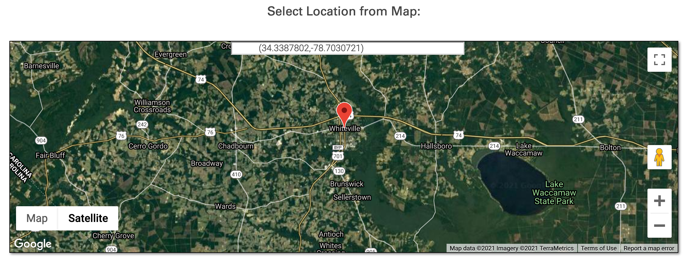
Select a location by clicking on the map or typing an address into the address bar and selecting a location from the dropdown that appears.

Step 3: Submit!
Once a location and at least one model have been selected, the "Submit" button will become enabled (it will turn red). Click this button to retrieve output.
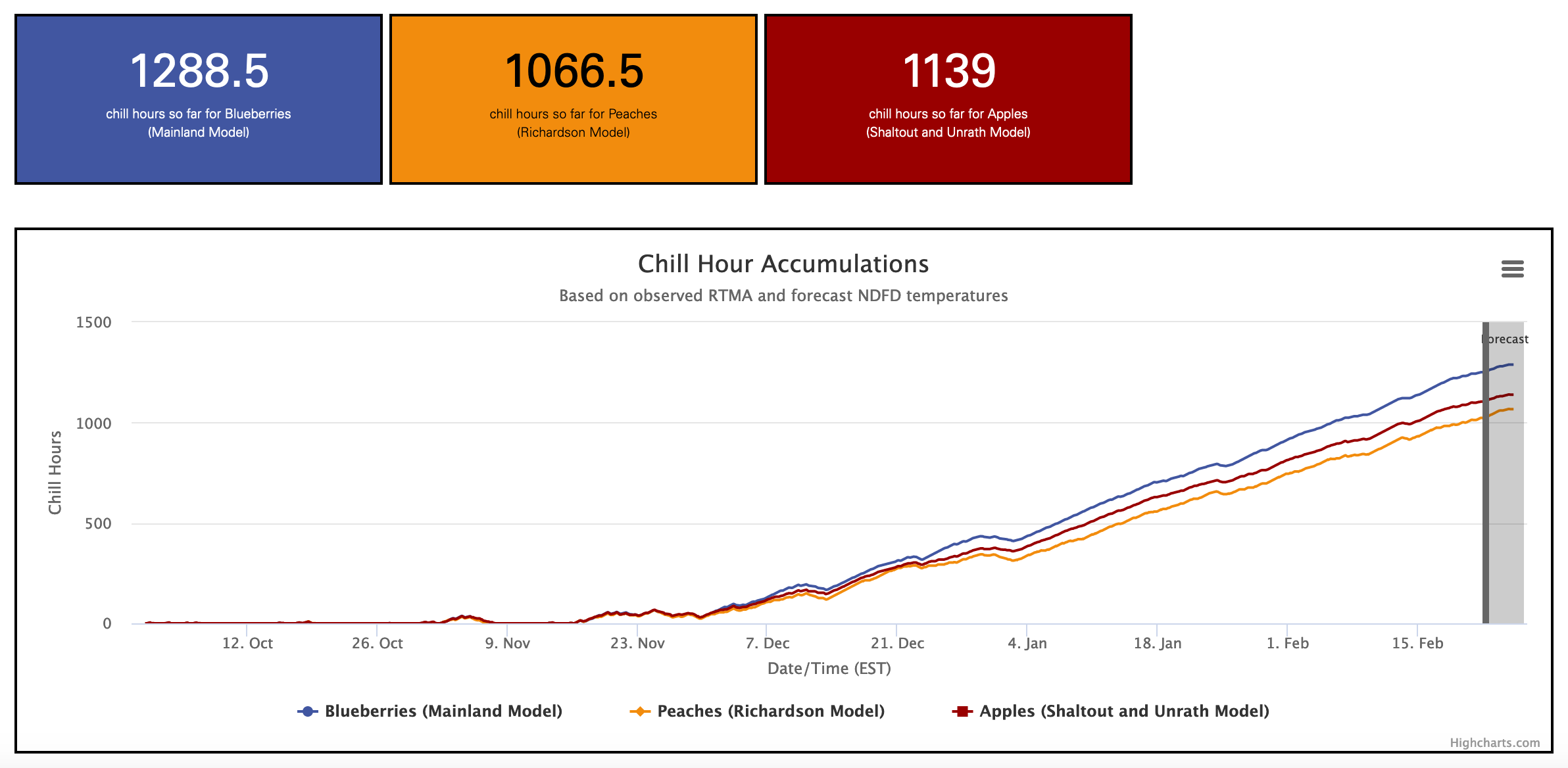
OutputThe output appears beneath the Submit button. At the top of the output are several "quick look" boxes that show season-to-date chilling hour accumulations for the selected models. Beneath these is a graph that shows the progression for each model. The graphs are interactive, and clicking the three-bar icon in the upper right enables you to download the graph as an image or the data as a .csv file. The second graph shows the hourly RTMA and NDFD temperature data which were used to compute chilling hours.
